I had a good conversation with David from OpenROV this morning.  We talked about potential partnerships, and I shared information about the Watershed Education Summit (WES), a project involving various El Dorado County high schools, the state Water Resources Control Board, the El Dorado County and Georgetown Divide Resource Conservation Districts, and the U.S. Forest Service.  From the website:

During the four-day event, students, teachers, and resource professionals work together to complete the following tasks: stream cross-sections, stream gradient and stream water flow and velocity measurements, substrate pebble counting, macroinvertebrate sampling, shade measurement, Global Positioning Satellite data collection, water chemistry testing, riparian vegetation measurement, and large woody debris location. Partnerships with the El Dorado Resource Conservation District and the State Water Resources Control Board’s Clean Water Team are instrumental in making WES a success.

In quadcopter news, the POs are in, so I think I’ll be picking the ELEV-8s up from Parallax this week.  The Go Pro HERO2s arrived last week, as well as some of the tools and odds and ends.  Still waiting on the batteries, receivers, and some other pieces, but we should be ready to fly in the next couple of weeks.

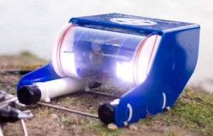
Photo CC BY-NC-SA from http://openrov.com

This little beauty is the OpenROV.  From the site:

OpenROV is a
 Do It Yourself telerobotics community centered around underwater exploration and education. We have developed a low-cost telerobotic submarine that can be built with mostly off-the-shelf parts.
The goal of OpenROV is to democratize exploration by allowing anyone to explore and study underwater environments.

I spent a few minutes in conversation with the creators this afternoon after they spoke at Maker Faire.  Since the start of the quadcopter project, I’ve been talking to Jason Pittman (Professor, Geosciences) about expanding our remote sensing capabilities, and bathymetry is part of that discussion.  The OpenROV folks seemed very open to and interested in partnering with educational institutions, so I’m looking forward to checking out their platform and finding out how we might be able to work together.

https://docs.google.com/document/d/1whawicjQdSDh1ohWF4-CDnSrrpkjfFtnpc6632vGBvg/edit

QR Code Generator – http://qrcode.kaywa.com/

http://www.kickstarter.com/projects/hunterd/zombie-based-learning-geography-taught-in-zombie-a

https://www.zombiesrungame.com/

http://www.dreamonapp.com/

https://www.youtube.com/watch?v=j9JXtTj0mzE&hd=1

http://www.nytimes.com/2012/05/03/education/harvard-and-mit-team-up-to-offer-free-online-courses.html?_r=2

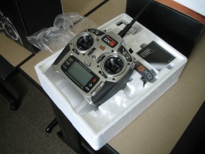
The quadcopter controllers arrived – specifically, a pair of Spektrum DX8s.  They’re complex-looking things, with numerous switches and dials.  They also have a sweet screen that will (as I understand it) display telemetry data.  I put in a requisition for the telemetry bits today, and these should be the last of the reqs for phase 1.


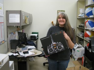
This is Tess holding the DX8 box.  If you’ve ever worked in an institutional or government context, you know that “getting things” takes a fair amount of work.  There are forms to be filled out in triplicate, arcane budget strings to be chanted, quotes to secure – much crossing of t’s and dotting of i’s.  Tess did the lion’s share of this work, and I am very grateful.  Thanks Tess!

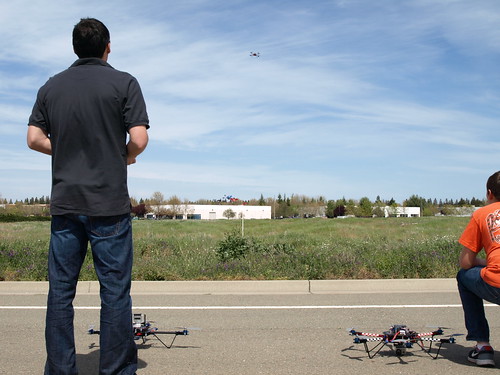
Kevin!Spent the afternoon out at Parallax in Rocklin.  Kevin and Nick and Ken flew various iterations of the ELEV-8 platform, and thrilled the gathered crowd with feats of derring-do.  Balloons were popped, streamers were clipped, and one flying machine landed in the drink.  A good time was had by all.

After the demo, the FLC contingent – Dan Ross (CIS and Engineering), Dave Myers (student and president of the recently chartered FLC Robotics Club) and I toured the facility, and I had the chance to talk to Nick about some of the particulars of FLC’s project, and to say hello to Jessica of Dweeb Den fame.  Can’t wait to get the quadcopters in and get them flying!  Below is a video of a two copters dogfighting, and here’s a link to the complete set of photos from today’s event.  Thanks to Jim and and the whole Parallax crew.

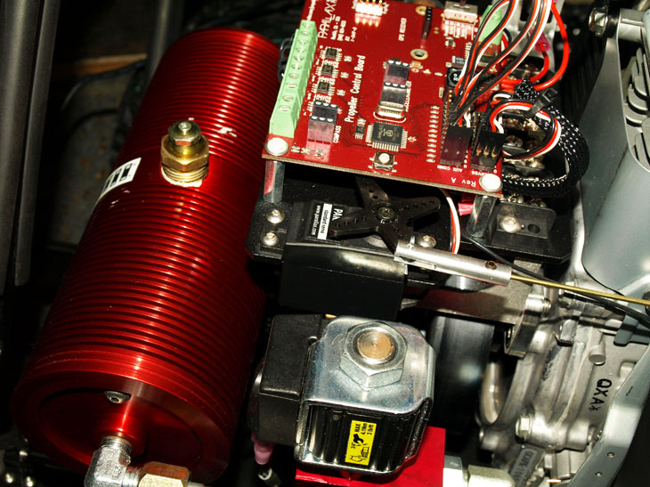
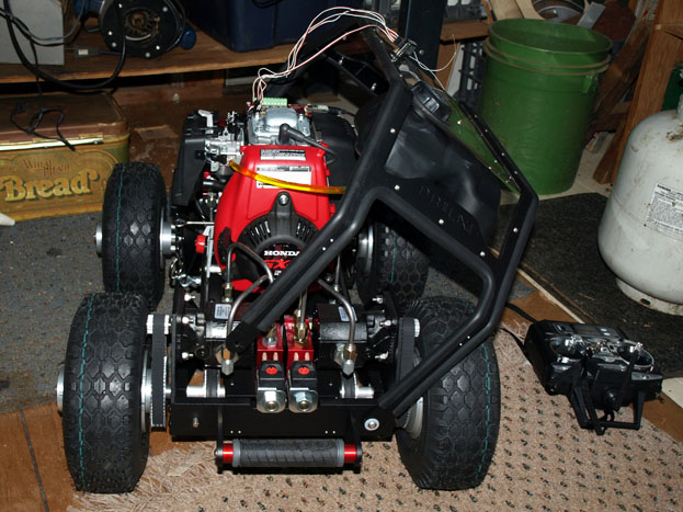
The trip to Parallax referenced in the previous post was a fruitful one indeed, as we (Folsom Lake College) ended up being the recipient of a sweet, brand new Propellor QuadRover.

The bot is a burly little beast, a sturdy metal frame housing a 4-stroke Honda gasoline engine, a hydraulic propulsion system, disc brakes, and a powerful Propeller microcontroller.

Spent Saturday trying to find ~4 cups of ISO-46 hydraulic fluid, and finally ended up buying 2.5 gallons, which means I ended up with all the robot will need for the foreseeable future.  In any event, the hydraulic system and the motor check out, and after charging the battery, I tried in vain to get the RC controller to communicate with the bot.  I’m pretty sure the receiver is shot, so I’m looking into either securing a new one, or undertaking the delicate soldering that will make it work.

What will we do with the QuadRover?  That remains to be seen.  I’ve lately been thinking of both the rover and the soon-to-arrive quadcopters as sensor platforms.  That is, the plan is to equip them with an array of sensors and data loggers, and figure out amazing instructional activities that make use of the data.  Ideally, I’ll get the whole system working, and then challenge students to come up with the use cases.  Any bright ideas?

Spent the morning at Parallax, meeting with various folks and talking about partnership opportunities and that sort of thing. Nick (he’s working on the ELEV=8 platform, and he’s helped me a great deal, answering technical questions and providing guidance) flew a Y-shaped ELEV-8 prototype for us.

Thanks Jim and Nick!

I got the blog up and running for a new project that Jason Pittman (Geosciences) and I are working on.

http://dolookdown.org and @DoLookDown on Twitter

The project will help FLC students develop technical geospatial analysis skills and learn contemporary applications of geospatial imaging, and the images will be used for spatial analysis; evaluating landscape changes, hazard analyses, and investigating rural and urban development.